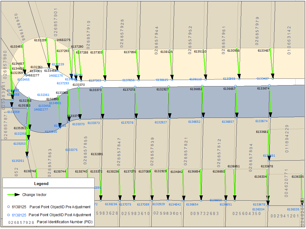
- Change vectors are provided as two-point line features with a “from” coordinate and “to” coordinate (X1,Y1 & X2,Y2).
- Line features in this product represent a single shift from the initial to final location during the requested time. A parcel point may have several locations during a selected period of time (as a result of a series of fabric improvements) but the intermediate locations are not captured.
The following table contains the Change Vector attributes and descriptions.
| Attribute Name | Description |
|---|---|
| GlobalID |
Unique global identifier for the feature Values: System-generated |
| PointID |
The PointID of the corresponding the Parcel Point feature Values: System-generated Unique ID Notes: A Change Vector feature will link to one Parcel Point feature only. |
| X1 |
The x-coordinate of the point at the beginning of the defined time period. Values: BC Albers metres Notes: This represents the “From” point of the vector. |
| X2 |
The x-coordinate of the point at the last published time. Values: BC Albers metres Notes: This represents the “To” point of the vector. |
| Y1 |
The x-coordinate of the point at the beginning of the defined time period. Values: BC Albers metres Notes: This represents the “From” point of the vector. |
| Y2 |
The y-coordinate of the point at the last published time. Values: BC Albers metres Notes: This represents the “To” point of the vector. |
| Shape | Contains geometry of the line feature in the requested Spatial Reference. |
An example below is a real case depiction of a spatial improvement project that PMBC completed in December 14, 2018 around the City of Armstrong. The figure illustrates the change vector showing the parcel point movement pre and post adjustment. In this instance there was an approximate shift of 15m.
Fabric Spatial Improvement – City of Armstrong, December 14, 2018
