On This Page
The Survey Plan Submission to Surveyor General (CLRS) form is used to submit all plans prepared pursuant to the Land Act, the Mineral Tenure Act, the Coal Act and well site plans prepared pursuant to Energy Resource Activities Act to the Surveyor General for filing in the Crown Land Registry.
A CLRS form is generated in SurveyHub when one of the above-noted plan types is selected.
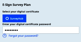
The CLRS form must be electronically signed by a BC land surveyor. See Obtain a Digital Certificate from Juricert.
This guide presumes that a survey site in SurveyHub has first been created. See https://help.ltsa.ca/ltsa-enterprise/survey-sites for survey site creation instructions.
The rest of this page provides CLRS form creation help after the SurveyHub Create Survey Plan button has been pressed.
The below images document the creation of a Land Act survey plan CLRS form. The steps are similar for the form creation for Mineral Tenure Act, Coal Act and Former Indian Reserve plans, with some small variation for plan type specific contextual form data. See Create Survey Plan - Well Site for well site specific instructions.
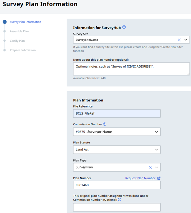
Survey Plan Information
Select a previously created SurveyHub Survey Site and specify a File Reference (the applicant’s file number), Plan Statute, Plan Type and a pre-assigned Plan Number.
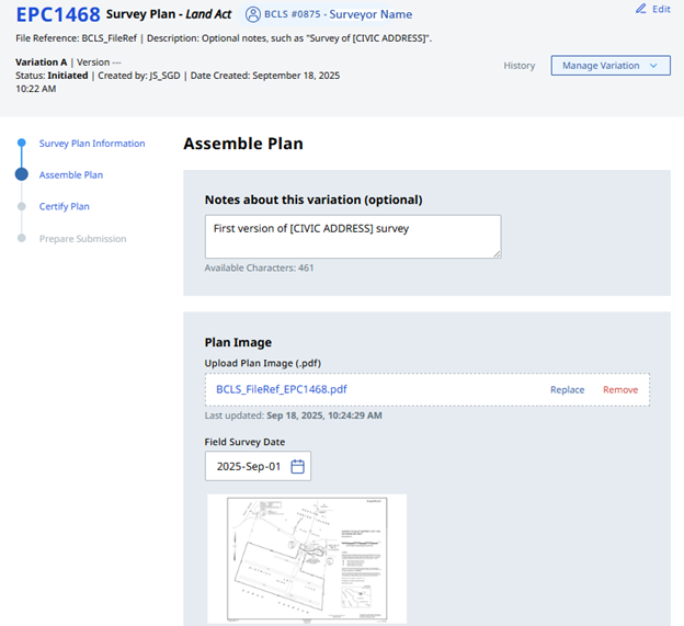
Assemble Plan
Optionally add variation notes, then upload a PDF of the completed survey plan and specify the Field Survey Date.
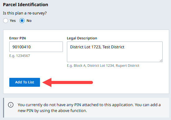
Specify whether or not the plan is a re-survey and enter all applicable PINs and legal descriptions. Press the Add To List button or otherwise the PIN and Legal Description information will not save.
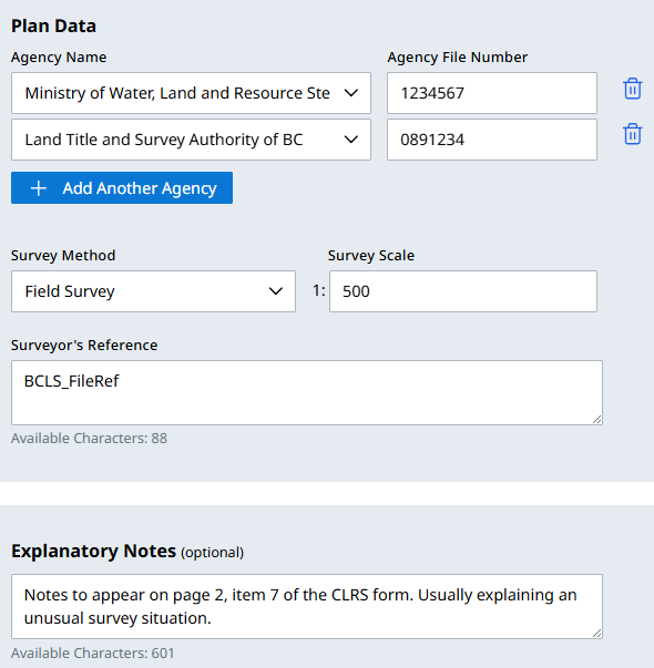
Enter all related agency names and file numbers. Specify the Survey Method type, Survey Scale and add the Surveyor’s File Reference.
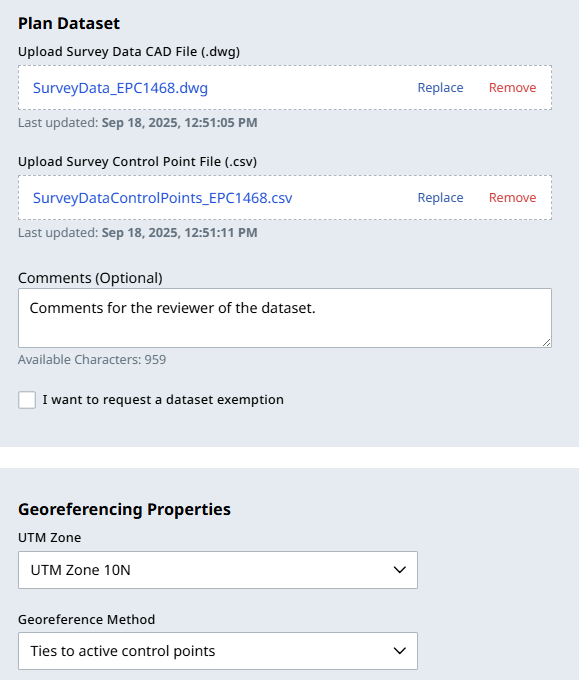
Upload the Survey Data CAD File (.dwg) and Survey Control Point (.csv) files. Also enter all Georeferencing Properties data
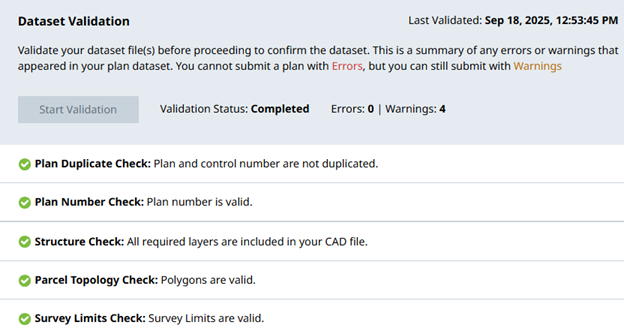
Click Start Validation and review the validation results. If needed, apply any needed corrections to the CAD files, remove and replace their upload and repeat the validation. You may override validation warnings if you believe it is appropriate to do so.
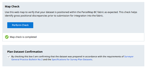
Perform the Map Check and if determined to be accurate, check the Plan Dataset Confirmation checkbox.
Certify Plan
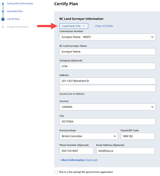
Enter the contact information for the surveyor who prepared the plan. This will appear in Item 1 “BC LAND SURVEYOR IDENTIFICATION” of the completed CLRS form. You may choose to save or load previously saved contact information with the Load/Save Info
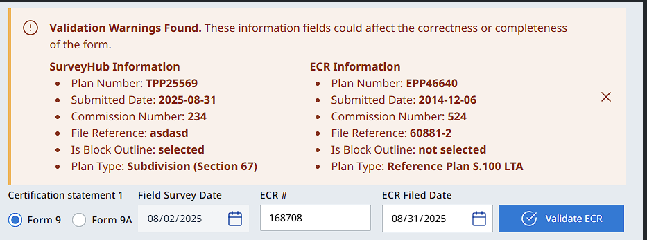
Add the Association of BC Land Surveyors Electronic Checklist Registry (ECR) information for this plan. You have the option to validate the information entered on the form with the Validate ECR button which may show warnings if found.
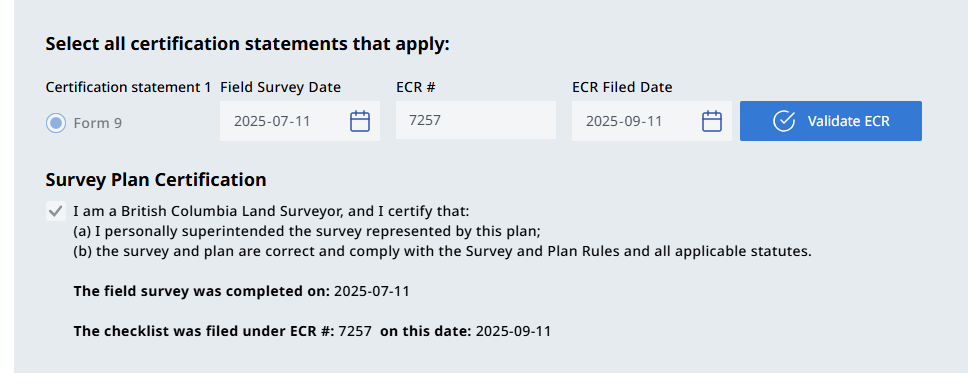
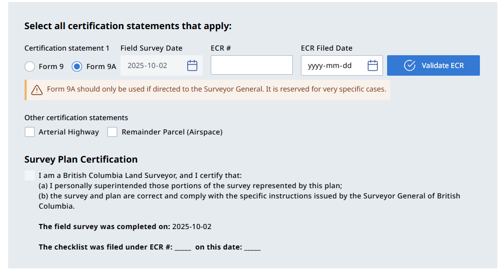
When ready, check the Survey Plan Certification checkbox.
Form 9 - Certification
Form 9A - Certification
You can preview the now fully drafted CLRS plan form to check it for omissions.
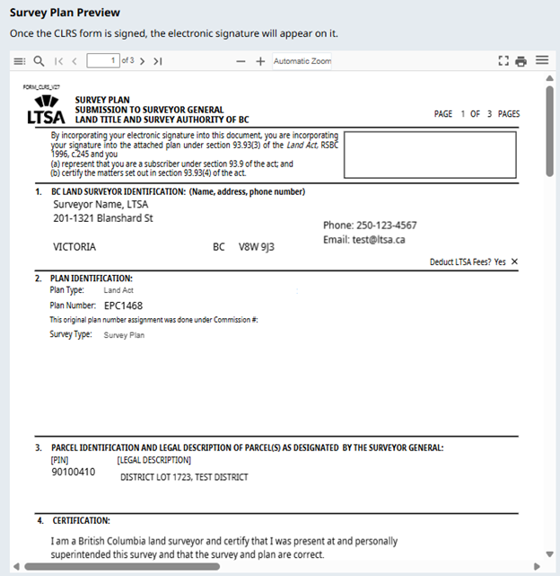
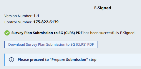
E-sign the survey plan.
Once signed, the version number and control number will display. The option to download the CLRS form becomes available.
Prepare Submission
Once the plan is e-signed, proceed to the Prepare Submission page and click Turn On Submission.
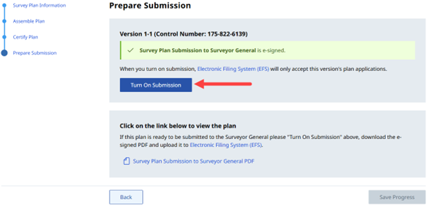
- To complete the submission, download the CLRS form and create an LTSA package submission to the Surveyor General. See How to Submit a Package to the Surveyor General for submission instructions.