All electronic plans submitted to the LTSA must be in Adobe's Portable Document Format (PDF). Electronic plans are converted to Tagged Image File Format (TIFF) by the LTSA when submitted.
PDFs of survey plans can be created from most of the drafting software commonly used by BC land surveyors. This is done through a print-to-PDF option or by choosing Adobe PDF as your printer. Some software packages can create PDFs without using Adobe Acrobat software. Technical support is provided only for documents generated by Adobe Acrobat Standard or Professional software.
Surveyors are encouraged to use standard fonts so that the final TIFF version of the plan remains an exact copy of the PDF. If the software the LTSA uses for this conversion does not recognize the font used in the PDF that is submitted, the software will substitute all text with a default font. This could affect the appearance and legibility of the plan.
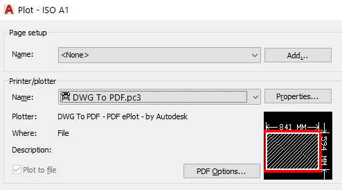
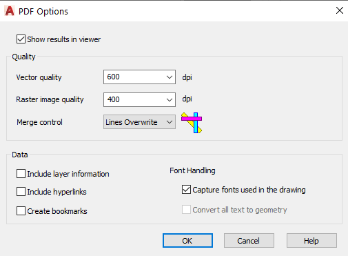
To avoid font substitution issues please ensure that your plot to PDF options are set to include/embed Fonts within the PDF. An example of this setting within AutoCAD is shown below. Similar settings should be available in other Print to PDF software.
|
|
Document and plan requests are delivered in PDF format, rather than a TIFF image. PDF format provides better quality screen display and printing options, and can be saved as different file formats when using Adobe Acrobat.
Technical Specifications for PDF Plan Images
PDF plan images must:
- Meet PDF 1.5 specification or higher (i.e., adhering the LTSA system requirements for Adobe Acrobat)
- Not contain embedded WordPerfect fonts
- Must be generated from drafting software (not from a scanned paper or Mylar print-out) if attached to the Surveyor Certification form
Depending on your method of PDF generation and the settings in your software, upon submission of your plan in LTSA's Electronic Services you may receive a warning message as shown below.

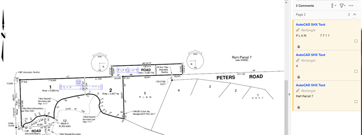
The annotations that the warning is referring to may be caused by AutoCAD SHX text being plotted in the PDF as comments similar to as shown below for the ghosted text elements.
To remove this warning message you may wish to replot your survey plan after reviewing the article linked here and changing the PDFSHX variable to 0. This should eliminate the plotted items from showing up in the PDF as comments which is causing the warning message to be displayed.
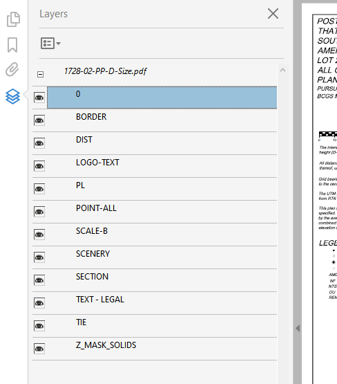
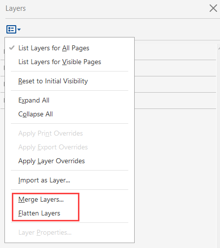
Another item to watch for that may cause validation warnings is the inclusion of layer information within the PDF. If after plotting to PDF the resulting file has layers as shown below, the layers should be flattened before inserting into the SPC form and applying your digital signature.
|
|
Plan Registration Advisories
A Plan Registration Advisory notifies a BC land surveyor when a plan associated with their Commission Number is registered in the land title office. As a BC land surveyor, you have the ability to customize the delivery method for Plan Registration Advisory notifications or opt out of the service. An option to receive a copy of newly registered plans for the standard plan order fee with the notification is also available. See Set Surveyor Plan Notification Options.